Short answer: The North Fork, St. Lucie Aquatic Preserve protects 2,972 acres of state-owned river bottom along about 16 miles of the North Fork of the St. Lucie River, from Midway Road in White City south into Martin County. FDEP says that portion was designated in 1972. State law limits dredging, filling and new structures there, seagrass damage can bring a fine of up to $1,000, and there are no fees. FDEP lists access points including Veterans Park at Rivergate, the Oxbow Eco-Center and Savannas Preserve State Park.
Last verified: October 22, 2026, against the sources listed at the end of this page.
What is the North Fork, St. Lucie Aquatic Preserve?
The North Fork, St. Lucie Aquatic Preserve is a 2,972 acre band of state-owned river bottom along about 16 miles of the North Fork of the St. Lucie River, designated in 1972 and spanning St. Lucie and Martin counties.
The Florida Department of Environmental Protection's Office of Resilience and Coastal Protection lists the preserve with Counties: St. Lucie, Martin, Established: 1972 and Acres: 2,972, and describes its waters as riverine, flood plain and estuarine communities (FDEP preserve page). The same page counts 43 designated aquatic preserves statewide covering more than 2.9 million acres of submerged lands, and says a 16-mile portion of the North Fork was designated in 1972 to protect its aesthetic, biological and scientific value for future generations.
In law, the preserve is item (12) of section 258.39 of the Florida Statutes, which defines it as described in the Official Records of Martin County in Book 337, pages 2159-2162, and in the Official Records of St. Lucie County in Book 201, pages 1676-1679 (Florida Statutes section 258.39).
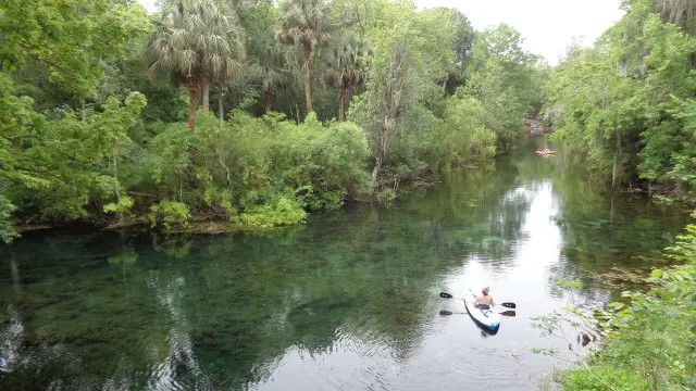
The FDEP page lists what visitors do on the North Fork of the St. Lucie: fishing, canoeing, kayaking, motorboating, sailing, birding and nature viewing (recreational activities listed by FDEP). It describes visitation as open 24/7, dependent on public access points managed by other entities, and its FAQ states there are no fees.
Where does the North Fork aquatic preserve begin and end?
The preserve runs from Midway Road in White City at its north end down to a line from Coconut Point in Stuart to Jenkins Point in Palm City, just west of the Roosevelt Bridge in Martin County.
FDEP places the North Fork, St. Lucie preserve about 40 miles northwest of West Palm Beach and says its eastern and western boundaries take in state-owned sovereign submerged lands below the mean high water line (FDEP boundary description). The preserve stretches about 16 miles along the river's natural bends.
State park land borders part of the river. The Savannas Preserve State Park unit management plan describes a North Fork property located entirely west of U.S. 1 that buffers the North Fork of the St. Lucie River, notes that 241 acres of that property were acquired jointly by the Trustees and the South Florida Water Management District, and puts the whole park at 6,877 acres (Savannas Preserve State Park unit management plan).
The same plan states that the park is adjacent to the North Fork St. Lucie River Aquatic Preserve as designated under the Florida Aquatic Preserve Act of 1975, and that most of the North Fork proper and a portion of the St. Lucie Estuary are an aquatic preserve and Outstanding Florida Waters (designations in the Savannas plan). The FDEP preserve page gives 1972 as the year the North Fork portion was designated.
What rules apply on the water in the North Fork preserve?
State law bars new dredging, filling, mining, drilling and most new structures in an aquatic preserve such as the North Fork except under listed permits, and FDEP warns that damaging seagrass can bring a fine of up to $1,000.
For the North Fork and every other aquatic preserve, section 258.42 of the Florida Statutes directs the Board of Trustees of the Internal Improvement Trust Fund to maintain aquatic preserves under these conditions, among others (Florida Statutes section 258.42):
- No further sale, lease or transfer of sovereignty submerged lands unless it is in the public interest; aquaculture leases may be authorized.
- No further dredging or filling except permitted minimum dredging for public navigation, marinas, piers and docks, maintenance of existing channels and public utilities.
- No drilling of gas or oil wells, and no excavation of minerals except dredging of dead oyster shells approved by the Department of Environmental Protection.
- Structures may not be erected except private residential docks for reasonable ingress and egress, qualifying multislip and commercial docks, and shore protection, navigational aids or utility crossings.
- No wastes or effluents discharged into the preserve that substantially inhibit the purposes of the act.
For people on the North Fork of the St. Lucie in a boat or kayak, the FDEP FAQ points to current FWC saltwater fishing and boating regulations, says seagrass is protected within aquatic preserves, and advises avoiding shallow waters and raising the motor over seagrass (FDEP safety and rules FAQ). Pets are allowed, but FDEP asks owners not to let them run free outside designated areas near nesting birds and to pick up after them.
An injured animal or environmental damage on the North Fork of the St. Lucie is reported to the Florida Fish and Wildlife Conservation Commission at 1-888-404-FWCC (3922), the number the FDEP preserve page gives (FDEP reporting guidance). The same statute also lets a riparian owner selectively trim mangroves on adjacent public submerged lands only in compliance with sections 403.93 to 403.938 (mangrove trimming provision).
Where can people launch a kayak or boat onto the North Fork?
FDEP lists access locations for the North Fork of the St. Lucie aquatic preserve, including White City Park and Sandpiper Bay Marina, and the city and county pages for Veterans Park at Rivergate and the Oxbow Eco-Center give addresses and hours.
Parking is dependent on each location, FDEP says, and it lists White City Park, River Park Marina, Veterans Park at Rivergate, Sandpiper Bay Marina, C-24 Canal Park, Oxbow Eco-Center and Savannas Preserve State Park; its boat ramp list names White City Park, River Park Marina, Veterans Park at Rivergate, C-24 Canal Park and Savannas Preserve State Park (FDEP visitation information). The table pairs those North Fork access points with what each managing agency's page states.
| Access point | Official details |
|---|---|
| Veterans Park at Rivergate, Port St. Lucie | 2200 SE Veterans Memorial Parkway, Port St. Lucie 34952; three boat ramps open 24/7 with lighted car and trailer parking; handicapped boat entry lift; Riverwalk Boardwalk with fishing; 772-878-2277 (City of Port St. Lucie) |
| Oxbow Eco-Center, Port St. Lucie | 225 acres along the North Fork; 5400 NE St. James Drive, Port St. Lucie 34983; (772) 785-5833; preserve trails sunrise to sunset, 365 days; admission free (St. Lucie County) |
| Savannas Preserve State Park, Halpatiokee Nature Trail | ADA accessible kayak launch with a wheelchair transfer system and paved parking; entrance on U.S. 1 south of Southeast Village Green Drive, about 3/4 mile north of Walton Road (FDEP accessibility answer) |
| White City Park, River Park Marina, C-24 Canal Park | Listed by FDEP as boat access and ramp locations for the preserve (FDEP boat ramp list) |
| Sandpiper Bay Marina | Listed by FDEP as a parking location only (FDEP parking list) |
For a longer paddle, St. Lucie County's Environmental Resources Department describes a Ten Mile Creek/North Fork Paddling Trail that extends from the westernmost headwaters west of McCarty Rd. to the confluence with the St. Lucie Inlet, and says it manages 11 preserves abutting that corridor (St. Lucie County greenways and paddling trails). FDEP adds that ecotour operations provide pontoon trips about the preserve's biology and ecology, and names the Oxbow Eco-Center under its educational opportunities (FDEP educational opportunities).
What lives in the North Fork of the St. Lucie River?
The North Fork shifts from a freshwater system upstream to a brackish one near the St. Lucie Estuary, and FDEP lists manatees, dolphins, snook, tarpon, oysters, river otters and alligators among its residents.
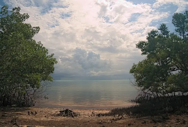
Habitats in the North Fork of the St. Lucie preserve include freshwater tidal swamps, estuarine mangrove forests and oyster reefs, according to FDEP (FDEP wildlife and habitat list). Its species list names oysters, horseshoe crab and blue crab; wading birds, sea birds and shore birds; Atlantic bottlenose dolphins, manatees, bobcat, river otter and raccoon; the Atlantic salt marsh snake, terrapin, sea turtle and American alligator; snapper, snook, mullet, tarpon, drum, shrimp and opossum pipefish; and seagrass, red, black and white mangroves and marsh grass.
Conservation work on the North Fork, as FDEP lists it, covers protecting bird nesting areas, oyster reef and seagrass restoration, hydrologic restoration, submerged aquatic vegetation restoration, and public education and outreach. Research named on the page includes a snook dietary study by the Florida Fish and Wildlife Conservation Commission, fish spawning and plankton research by the South Florida Water Management District, and benthic infaunal research by the Smithsonian Marine Station (FDEP conservation and research).
Water quality on the North Fork depends on a much larger system. The Savannas Preserve plan says the entire St. Lucie River system was most likely predominantly freshwater until a permanent inlet to the Atlantic Ocean opened during the 1890s, and that the hydrology of the North Fork and its headwaters has been severely altered for navigation and drainage (North Fork hydrology in the Savannas plan). The Indian River Lagoon plan adds that construction of the St. Lucie Canal began in 1915 and that by 1923 water from Lake Okeechobee was flowing through it into the St. Lucie River (IRL Aquatic Preserves management plan).
What is the history and geology of the North Fork?
FDEP traces people on the North Fork back to the Ais, documented beside the St. Lucie River in 1568, and to the Seminoles, who used the river as a route north toward the St. Johns River marshes.
The FDEP archaeological summary says the Ais were decimated by 1763, when the British took possession of Florida, and that the Seminoles then used the North Fork as a transportation route linking the St. Lucie River area with the lower St. Johns River marshes to the northwest (FDEP archaeological information). It adds that large military forces are believed to have traveled through the area during an 1838 winter campaign of the Second Seminole War, and that the earliest European settlements along the river date to the 1890s at Spruce Bluff and White City, with Spruce Bluff the first organized non-Indian settlement.
Beneath the North Fork, FDEP describes four surface geological formations, the Atlantic Coastal Ridge, the Eastern Valley, Green Ridge and the Osceola Plain, made of sand, clay and shell layers, and a Pliocene formation dating back over 5.3 million years that holds diverse fossils (FDEP geological information). The legend of the Indian River Lagoon plan's system geomorphology map lists the Atlantic Coastal Ridge, Eastern Valley, Green Ridge and Osceola Plain features along with a Ten Mile Ridge (IRL plan geomorphology map).
Who manages the North Fork preserve, and how can people help?
FDEP's Indian River Lagoon Aquatic Preserves team manages the North Fork from a field office at 3300 Lewis Street in Fort Pierce, and the contact number on the FDEP preserve page is 772-448-5930.
The Indian River Lagoon Aquatic Preserves System Management Plan says the field office sits on public land managed by Savannas Preserve State Park at the confluence of Five Mile and Ten Mile creeks, tributaries to North Fork St. Lucie River Aquatic Preserve, and that a satellite office at St. Sebastian River Preserve State Park in Fellsmere has been used since summer 2008 (IRL Aquatic Preserves System Management Plan). The plan also says the North Fork, along with Mosquito Lagoon and Loxahatchee River-Lake Worth Creek, is addressed by its own separate management plan rather than the four-preserve lagoon plan.
Volunteers with the Indian River Lagoon Aquatic Preserves help with wildlife monitoring, annual seagrass monitoring and microplastic sampling, and on spoil islands with invasive plant removal and installing picnic tables and fire rings, FDEP says; the contact is [email protected] (FDEP volunteer opportunities). St. Lucie County's Oxbow Eco-Center on the North Fork also takes volunteers and runs school, youth and adult programs (Oxbow Eco-Center programs).
FDEP's FAQ calls the North Fork a year round destination, with winter the coolest weather and calmer waters in the summer (FDEP best time to visit). For the neighboring lagoon preserve between Vero Beach and Fort Pierce, see the Treasure Coast environment guides.
Last verified: October 22, 2026, against a new read of the FDEP North Fork, St. Lucie preserve page, sections 258.39 and 258.42 of the Florida Statutes, the Indian River Lagoon preserves plan, the Savannas Preserve State Park plan, St. Lucie County's Oxbow and paddling trail pages and Port St. Lucie's Veterans Park at Rivergate page.
Frequently asked questions
How big is the North Fork, St. Lucie Aquatic Preserve?
FDEP lists it at 2,972 acres, covering about 16 miles of the North Fork of the St. Lucie River in St. Lucie and Martin counties.
Is there a fee to paddle the North Fork aquatic preserve?
No. FDEP says there are no fees, and the preserve is open 24/7 through public access points that other agencies manage.
Can a dog come along on the North Fork of the St. Lucie River?
Yes. FDEP allows pets but asks owners to keep them out of undesignated areas near nesting birds and to pick up after them.
Where is there an accessible kayak launch on the North Fork?
Savannas Preserve State Park has an ADA accessible kayak launch at the Halpatiokee Nature Trail, entered from U.S. 1 about 3/4 mile north of Walton Road in Port St. Lucie.
What is the fine for damaging seagrass in the North Fork preserve?
FDEP says damage to seagrass can result in a fine of up to $1,000, and it advises raising the motor over seagrass.
Sources
- FDEP ORCP: North Fork, St. Lucie Aquatic Preserve https://floridadep.gov/rcp/aquatic-preserve/locations/north-fork-st-lucie-aquatic-preserve Used for: acreage, counties, established, boundaries, access points, rules FAQ, wildlife, history, geology, volunteering
- Florida Statutes 258.39 https://www.flsenate.gov/Laws/Statutes/2025/258.39 Used for: legal description (12)
- Florida Statutes 258.42 https://www.flsenate.gov/Laws/Statutes/2025/258.42 Used for: maintenance rules for aquatic preserves
- IRL Aquatic Preserves System Management Plan https://floridadep.gov/sites/default/files/Indian-River-Lagoon-AP-System-Management-Plan.pdf Used for: field office, separate plan for North Fork, St. Lucie Canal history, geomorphology
- Savannas Preserve State Park Unit Management Plan https://softlive.floridadep.gov/sites/default/files/SPSP_UMP_ARCdraft_20170718%20-%20FINAL%20wARC%2010.20.2017%20Approval%20LTR.pdf Used for: North Fork property, 241 acres, 6,877 acres, OFW, Aquatic Preserve Act 1975, 1890s inlet
- St. Lucie County Oxbow Eco-Center https://www.stlucieco.gov/departments-and-services/oxbow-eco-center Used for: 225 acres on the North Fork, address, phone, free, trails
- St. Lucie County Greenways and Paddling Trails https://www.stlucieco.gov/departments-and-services/environmental-resources/greenways-paddling-trails Used for: Ten Mile Creek/North Fork Paddling Trail, 11 preserves
- City of Port St. Lucie Veterans Park at Rivergate https://www.cityofpsl.com/Government/Your-City-Government/Departments/Parks-Recreation/Parks/Veterans-Park-at-Rivergate Used for: three ramps 24/7, address, phone
Published by Rytas Dirse, Solo Founder & AI Architect
Built with AI, held to quality gates. US sources, US brands, facts only.
How this page was made
Digital Towns uses AI assistance to research and write its guides, and every page is only as good as the sources it cites. Our goal is the most accurate, useful local information possible.
If you see an error, or anything you can show is false, tell us right away and we will take a third look.
Report an error
Thank you. We'll take a third look and correct the page if it's wrong.