Short answer: Two state aquatic preserves cover Treasure Coast waters near Fort Pierce: the 11,000 acre Indian River-Vero Beach to Fort Pierce preserve in the lagoon, established in 1969, and the 2,972 acre North Fork, St. Lucie preserve, established in 1972. The Fort Pierce Inlet, cut in 1921, is covered by a May 2022 state plan whose initial target is 140,000 cubic yards of sand a year bypassed to the south. St. Lucie County's sea turtle season runs March 1 through Nov. 15, with beach lighting guidance and a year-round bonfire ban.
Last verified: October 22, 2026, against the sources listed at the end of this page.
Which environmental rules shape the Treasure Coast waterfront?
Around Fort Pierce and Port St. Lucie, the main rules come from two state aquatic preserves, a state sand plan for the Fort Pierce Inlet and St. Lucie County's sea turtle season.
Florida law lists the Indian River-Vero Beach to Fort Pierce Aquatic Preserve as item (8) and the North Fork, St. Lucie Aquatic Preserve as item (12) of section 258.39, each defined by pages in the county official records of Indian River, St. Lucie and Martin counties (Florida Statutes section 258.39). Both are managed by the Florida Department of Environmental Protection's Indian River Lagoon Aquatic Preserves team, which lists the same contact line, 772-448-5930, on each preserve page (FDEP Vero Beach to Fort Pierce preserve page).
The Fort Pierce Inlet has its own state plan, adopted by FDEP in May 2022 under section 161.161 of the Florida Statutes, which sets how much sand moves past the inlet to the beaches south of it (Ft. Pierce Inlet Management Plan). On the beaches themselves, St. Lucie County publishes sea turtle season rules for lighting, windows, bonfires and dogs (St. Lucie County sea turtle information).
Which aquatic preserves protect Treasure Coast waters, and how do they differ?
The Indian River-Vero Beach to Fort Pierce Aquatic Preserve covers 11,000 acres of lagoon in Indian River and St. Lucie counties, while the North Fork, St. Lucie Aquatic Preserve covers 2,972 acres of river in St. Lucie and Martin counties.
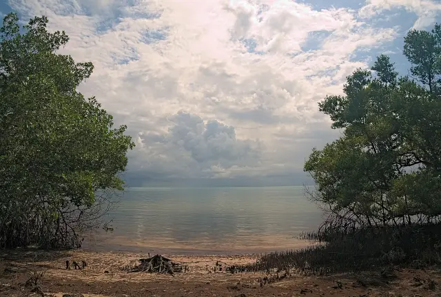
FDEP describes the Vero Beach to Fort Pierce preserve as part of the Indian River Lagoon, a long, wide and shallow estuarine lagoon mixing fresh water from rivers and creeks with salt water from the ocean (FDEP lagoon preserve page). It has no on-site parking or facilities; FDEP points to Fort Pierce Inlet State Park next door for parking, restrooms, a kayak launch and boat ramps, and lists the Round Island and Stan Blum boat ramps and the Ft. Pierce Inlet State Park kayak launch for access.
| Item | Indian River-Vero Beach to Fort Pierce | North Fork, St. Lucie |
|---|---|---|
| Counties | Indian River, St. Lucie | St. Lucie, Martin |
| Established | 1969 | 1972 |
| Acres | 11,000 | 2,972 |
| Type of water body | Shallow estuary, barrier island, spoil islands | Riverine, flood plain, estuarine communities |
| Activities listed | Fishing, boating, hiking, birding, beach activities, camping | Fishing, canoeing, kayaking, motorboating, sailing, birding, nature viewing |
| Best time to visit (FDEP FAQ) | Fall and spring | Year round |
Values in the table come from the two FDEP preserve pages (Vero Beach to Fort Pierce preserve; North Fork, St. Lucie preserve). Both pages describe visitation as open 24/7 through public access points managed by other entities, list no fees, and state that seagrass is protected, with damage carrying a fine of up to $1,000.
The lagoon preserve is one of four covered by the Indian River Lagoon Aquatic Preserves System Management Plan, which gives a combined acreage of 91,000 acres across Brevard, Indian River, St. Lucie, Martin and Palm Beach counties and 35,898 acres of seagrass bed (IRL Aquatic Preserves System Management Plan). The same plan says the North Fork is addressed by a separate individual management plan.
What are the spoil islands in the Indian River Lagoon near Fort Pierce?
Spoil islands are islands built from dredge material when the Intracoastal Waterway was dug, and FDEP says they now hold most of the bird rookeries in the lagoon's aquatic preserves.
On the Vero Beach to Fort Pierce preserve page, FDEP explains that the deposited material is sand, shell, muck and limestone rubble, that much of the island vegetation is exotic Brazilian pepper and Australian pine, and that the shallow edges have been colonized by mangrove forest, salt marsh and seagrass beds (FDEP spoil islands description). The islands also give boaters places to stop along the Indian River Lagoon.
The Indian River Lagoon plan dates much of that landscape: in the 1950s, it says, more than one hundred new spoil islands were created along the lagoon with dredging of the Intracoastal Waterway to a new depth of twelve feet (IRL plan history).
Wildlife FDEP lists for the lagoon preserve near Fort Pierce includes oysters, horseshoe crabs and seahorses, Atlantic bottlenose dolphin and West Indian manatee, green and loggerhead sea turtles, and redfish, black drum, tarpon, snook and mullet (FDEP lagoon wildlife list). Its volunteer work centers on beach and spoil island cleanups through the Indian River Lagoon Aquatic Preserves office.
How is the Fort Pierce Inlet managed, and why does sand get bypassed?
The Fort Pierce Inlet is a dredged inlet, cut on May 8, 1921, and the state's May 2022 inlet management plan sets an initial sand bypass target of 140,000 cubic yards a year to the beaches south of it.
According to the Ft. Pierce Inlet Management Plan, the Ft. Pierce Inlet District was created in 1918 by the Florida Legislature as a special taxing district covering most of St. Lucie County; dredging began in 1920, and the original channel was four feet deep and 100 feet wide between coquina rock jetties 400 feet long (inlet history in the FDEP plan). Between 1926 and 1927 the district rebuilt the jetties and extended them to 1,800 feet on the north and 1,200 on the south.
Federal responsibility came with the Rivers and Harbors Act of August 30, 1935, the plan says, and the U.S. Army Corps of Engineers completed the federal project in 1938 (federal project history). Between 1930 and 2021, 3,452,600 cubic yards of material was dredged from the Fort Pierce Inlet, and between 1973 and 2017, 473,250 cubic yards of that sand was placed on the beach south of the inlet.
The plan's strategies call for sand bypassing from the inlet to the beaches south of the south jetty between FDEP reference monuments R34 and R41, and say the 140,000 cubic yard target may be modified or updated based on a minimum of four years of additional monitoring data (inlet management strategies). The May 2022 plan also states that the county and the Corps were evaluating the feasibility of stabilizing the 1.3 mile beach management project south of the Fort Pierce Inlet with a groin field.
What sea turtle rules apply on St. Lucie County beaches?
St. Lucie County's sea turtle nesting season runs March 1 through Nov. 15, and during it the county asks that exterior lights be modified or turned off so they are not directly visible from the beach between sunset and sunrise.
The county says its 21 miles of beaches are nesting grounds for green, leatherback and loggerhead turtles, and that in the last season the first recorded nest was laid in late February (St. Lucie County sea turtle information). Window treatments are required on all windows of single and multi-story structures within the line of sight of the beach, with blackout draperies or shade screens preferred and approved window tint as an alternative.
Other St. Lucie County beach rules on the same page: bonfires are prohibited on all county beaches year-round, beach furniture should not be left out overnight, pits, holes and sandcastles can become pitfalls that trap hatchlings, so beachgoers are asked to leave the beach as they found it, and regular flashlights are discouraged during nesting season, though red or infrared light is fine (county beach practices). Walton Rocks Beach is the only dog-approved beach in St. Lucie County, and dogs there should be leashed.
Sick, injured, entangled or dead sea turtles on St. Lucie County beaches are reported to the FWC Wildlife Alert Hotline at 888-404-FWCC (3922), the county says, and it points to a sea turtle nesting dashboard for current nest counts rather than publishing them on the rules page (county reporting guidance).
Which Treasure Coast environment guide answers which question?
The North Fork, St. Lucie Aquatic Preserve guide is the detailed guide in this section, and related Treasure Coast guides on parks, beaches and history cover the inlet park, the dog beach and the Urca de Lima wreck.
| Question | Key fact | Guide |
|---|---|---|
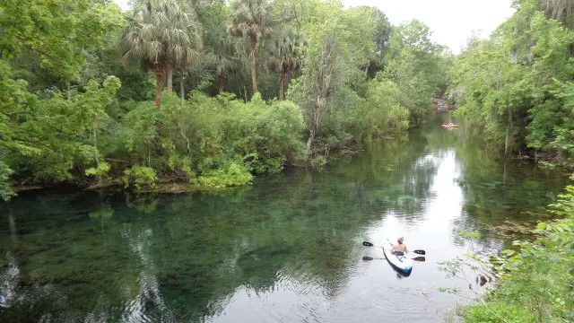
| What does the North Fork preserve protect, and where can a kayak go in? | 2,972 acres along about 16 miles of the North Fork (FDEP) | North Fork, St. Lucie Aquatic Preserve guide |
| Where is parking for the lagoon preserve near the Fort Pierce Inlet? | Fort Pierce Inlet State Park, adjacent to the preserve (FDEP) | Fort Pierce Inlet State Park guide |
| Which St. Lucie County beach allows dogs? | Walton Rocks Beach is the only dog-approved beach (St. Lucie County) | Dog-friendly beaches guide |
| Where do sea turtle rules apply on the barrier island? | 21 miles of St. Lucie County beaches (St. Lucie County) | Hutchinson Island beaches guide |
History on the water is covered too: the Urca de Lima underwater preserve guide in the Treasure Coast history section covers that preserve, and the Treasure Coast recreation guides cover fishing at the Fort Pierce Inlet jetties and public piers (FDEP notes historic sites along the lagoon). FDEP's lagoon page adds that many historic shell mounds along the lagoon were destroyed for road fill for U.S. Highways 1 and A1A.
Last verified: October 22, 2026, after re-reading both FDEP preserve pages for the Treasure Coast, section 258.39, the Indian River Lagoon preserves plan, the May 2022 Ft. Pierce Inlet Management Plan and St. Lucie County's sea turtle season page.
Frequently asked questions
Which aquatic preserves cover waters near Fort Pierce and Port St. Lucie?
FDEP lists the Indian River-Vero Beach to Fort Pierce preserve in Indian River and St. Lucie counties and the North Fork, St. Lucie preserve in St. Lucie and Martin counties.
When is sea turtle nesting season in St. Lucie County?
March 1 through Nov. 15, according to St. Lucie County, which notes that last season's first recorded nest came in late February.
Are bonfires allowed on Treasure Coast beaches in St. Lucie County?
No. St. Lucie County says bonfires are prohibited on all county beaches year-round, not only during sea turtle season.
When was the Fort Pierce Inlet cut?
The final barrier cut was made on May 8, 1921, after dredging began in 1920, according to the FDEP Ft. Pierce Inlet Management Plan.
Is there a fee to visit the Indian River Lagoon aquatic preserve near Fort Pierce?
No. FDEP lists no fees, and the preserve is reached through access points such as Fort Pierce Inlet State Park and the Round Island and Stan Blum boat ramps.
Sources
- FDEP ORCP: Indian River-Vero Beach to Fort Pierce Aquatic Preserve https://floridadep.gov/rcp/aquatic-preserve/locations/indian-river-vero-beach-fort-pierce-aquatic-preserve Used for: acreage, counties, established, access, spoil islands, wildlife, fees, shell mounds
- FDEP ORCP: North Fork, St. Lucie Aquatic Preserve https://floridadep.gov/rcp/aquatic-preserve/locations/north-fork-st-lucie-aquatic-preserve Used for: acreage, counties, established, type, activities, best time
- Florida Statutes 258.39 https://www.flsenate.gov/Laws/Statutes/2025/258.39 Used for: items (8) and (12)
- IRL Aquatic Preserves System Management Plan https://floridadep.gov/sites/default/files/Indian-River-Lagoon-AP-System-Management-Plan.pdf Used for: 91,000 acres, seagrass acreage, spoil island history, separate North Fork plan
- FDEP Ft. Pierce Inlet Management Plan (May 2022) https://floridadep.gov/sites/default/files/Ft.%20Pierce%20Inlet%20Management%20Plan_FINAL%2005-2022_.pdf Used for: inlet history, dredging totals, bypass target, strategies
- St. Lucie County sea turtle information https://www.stlucieco.gov/departments-and-services/environmental-resources/environmental-regulations-permits/sea-turtle-information Used for: season, lighting, windows, bonfires, dogs, hotline
Published by Rytas Dirse, Solo Founder & AI Architect
Built with AI, held to quality gates. US sources, US brands, facts only.
How this page was made
Digital Towns uses AI assistance to research and write its guides, and every page is only as good as the sources it cites. Our goal is the most accurate, useful local information possible.
If you see an error, or anything you can show is false, tell us right away and we will take a third look.
Report an error
Thank you. We'll take a third look and correct the page if it's wrong.