Short answer: Two city studies define Satellite Beach's sea level rise risk. A 2010 Climate Ready Estuaries report estimated about 5% of the city submerged at +2 feet of rise, 25% at +4 feet and 52% at +6 feet, measured from Banana River water level. The city plans with the Army Corps High projection, about 2.85 feet above 1992 sea level by 2070, and its City Projects page lists completed stormwater upgrades and a new fire station, Station 55, finished in 2025.
Last verified: October 21, 2026, against the sources listed at the end of this page.
Why is Satellite Beach exposed to sea level rise?
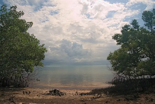
The 2010 report describes Satellite Beach as Holocene barrier island land whose topography falls westward, away from the Atlantic dune and toward the Banana River (2010 Climate Ready Estuaries report).
The 2010 study commissioned by the city describes the highest ground as barely above 20 feet, at the Atlantic dune, which otherwise averages about +15 feet above sea level, with roughly half of the city's landscape at +6 feet or less (2010 Climate Ready Estuaries report, hosted by the St. Johns River Water Management District). The same report says the entire Satellite Beach shoreline sits within the stretch of Brevard County beach south of Cape Canaveral that the Florida Department of Environmental Protection designated as critically eroded (2010 Climate Ready Estuaries report).
The April 2019 technical assessment adds the storm record: Satellite Beach took wind, rain and erosion impacts from storms including Erin (1995), Frances (2004), Jeanne (2004), Fay (2009), Matthew (2016) and Irma (2017), none of them a direct hit, and no part of Brevard County has had a direct landfall from a Category 3 or stronger hurricane in the record that begins about 1850 (2019 Sea-Level Rise Technical Planning Assessment). The same report notes that some of the worst local beach erosion comes from winter cold fronts and nor'easters rather than hurricanes (2019 Sea-Level Rise Technical Planning Assessment). Rain that runs off streets goes through storm drains straight to the Banana River Lagoon, a part of the Indian River Lagoon, without passing through a treatment plant (Satellite Beach Stormwater page).
What did the 2010 Satellite Beach sea level rise study find?
The 2010 Climate Ready Estuaries report found that about 5% of Satellite Beach would submerge at +2 feet of rise, 25% at +4 feet and 52% at +6 feet, measured against Banana River mean water level (2010 Climate Ready Estuaries report).
| Rise above Banana River mean water level | Share of the city submerged | Areas the report names | Source |
|---|---|---|---|
| +2 ft (0.6 m) | About 5% | Fringing wetlands and finger canal margins near the Banana River | 2010 Climate Ready Estuaries report |
| +4 ft (1.2 m) | 25% | Includes South Patrick Drive; limited flooding in northwest (Pelican Coast) and southwest residential corners | 2010 Climate Ready Estuaries report |
| +6 ft (1.8 m) | 52% | The entire western half centered on South Patrick Drive, much of Pelican Coast, southwest neighborhoods | 2010 Climate Ready Estuaries report |
Based mainly on the city's hypsographic curve, the report called +2 feet the tipping point toward catastrophic inundation and forecast it to occur around 2050 (2010 Climate Ready Estuaries report). It also warned that the function of critical assets such as fire and rescue, the South Patrick Drive evacuation route and the gravity-driven stormwater system would be compromised in proportion to the size of the rise (2010 Climate Ready Estuaries report).
The study was paid for by the U.S. Environmental Protection Agency's Climate Ready Estuaries program through the Indian River Lagoon National Estuary Program, with funding of $25,000 over one year, and was framed as a pilot for other east-central Florida towns (2010 Climate Ready Estuaries report). Its results went to a Sea-Level Rise Subcommittee of the city's Comprehensive Planning Advisory Board, a volunteer citizen board (2010 Climate Ready Estuaries report). The report dates from 2010, and its +2 foot forecast is that study's estimate rather than the projection the city plans with today.
What sea level projection does Satellite Beach plan for?
Satellite Beach's Comprehensive Plan uses the U.S. Army Corps of Engineers High projection through 2070, which the 2019 assessment puts at about 2.85 feet above 1992 mean sea level at the Daytona Beach Shores tide gauge (2019 Sea-Level Rise Technical Planning Assessment).
| Year | Feet above 1992 MSL | Source |
|---|---|---|
| 2020 | 0.50 | 2019 Sea-Level Rise Technical Planning Assessment |
| 2030 | 0.83 | 2019 Sea-Level Rise Technical Planning Assessment |
| 2040 | 1.22 | 2019 Sea-Level Rise Technical Planning Assessment |
| 2050 | 1.69 | 2019 Sea-Level Rise Technical Planning Assessment |
| 2060 | 2.23 | 2019 Sea-Level Rise Technical Planning Assessment |
| 2070 | 2.85 | 2019 Sea-Level Rise Technical Planning Assessment |
The 2019 report explains the choice: the community picked the High curve on the judgment that greater costs and disruption would follow if Satellite Beach failed to prepare its roads, drainage and critical facilities (2019 Sea-Level Rise Technical Planning Assessment). Daytona Beach Shores, NOAA gauge 8721120, was used because it is the nearest gauge to Satellite Beach with a published local trend, which the report gives as 0.091 inches per year, or about 9.1 inches over 100 years (2019 Sea-Level Rise Technical Planning Assessment).
The two studies use different reference points, so their numbers do not line up directly. The 2010 report measured rise from Banana River mean water level and tied its +2 foot tipping point to about 2050 (2010 Climate Ready Estuaries report), while the 2019 report measures from 1992 mean sea level at an ocean gauge and shows 1.69 feet for 2050 under the High curve (2019 Sea-Level Rise Technical Planning Assessment).
Which Satellite Beach buildings and drains face flooding in the studies?
The 2019 assessment expects occasional stormwater access problems by 2040 at five Satellite Beach buildings, becoming frequent by 2070 (2019 Sea-Level Rise Technical Planning Assessment).
The five are City Hall, the fire station, the police station, Public Works and the David R. Schechter Community Center (2019 Sea-Level Rise Technical Planning Assessment).
For Satellite Beach City Hall, the fire station and Public Works, the report's 2070 outlook adds potential stormwater flooding into the building, and for the Schechter Community Center occasional stormwater flooding into the facility (2019 Sea-Level Rise Technical Planning Assessment). The police station's 2070 entry stays at frequent access limitations (2019 Sea-Level Rise Technical Planning Assessment). These five sites were selected after discussions with the city's Floodplain Manager for field elevation checks, and the authors caution that their GNSS readings do not meet survey quality standards (2019 Sea-Level Rise Technical Planning Assessment).
Drainage is the other weak point. Because tidewater backing up into underground pipes is a common cause of drainage failure, the study mapped storm drain inlets whose inverts sit below projected Banana River water levels for 2015, 2040 and 2070 (2019 Sea-Level Rise Technical Planning Assessment). Inlets affected at mean high water would see tidewater backflow for at least half the year without upgrades, and those affected at seasonal high water for at least two weeks a year (2019 Sea-Level Rise Technical Planning Assessment).
The report also modeled the Satellite Beach tax base. Under the High projection for 2070 it estimated that less than 1% of total taxable value would be affected at local mean sea level, about 2% at seasonal high water and 2.5% at annual high water, or about $5 million, $16.5 million and $21.1 million (2019 Sea-Level Rise Technical Planning Assessment). For 2040 it put the effect under 1% at all three water levels (2019 Sea-Level Rise Technical Planning Assessment).
How has Satellite Beach written sea level rise into its plans?
According to the 2019 assessment, Satellite Beach in 2013 became the first city in Florida to amend its Comprehensive Plan with policy language for Adaptation Action Areas as a sea level rise strategy (2019 Sea-Level Rise Technical Planning Assessment).
A Satellite Beach follow-up project with the East Central Florida Regional Planning Council, funded through the Florida Department of Environmental Protection's Coastal Partnership Initiative, assessed the city's critical facilities for 2040, 2070 and 2100 and surveyed more than 400 residents and business owners online (2019 Sea-Level Rise Technical Planning Assessment). That work produced an inland flooding Adaptation Action Area, which the Comprehensive Plan defines as land in the Coastal High Hazard Area or FEMA 100-year flood zone, or land expected to flood under the Corps High projection for 2070, and treats as a tool for ranking flood projects (Section 5, Policy 1.14.3) (2019 Sea-Level Rise Technical Planning Assessment). The 2019 project itself ran three years with Florida Sea Grant support, and its partners were Stetson University's Institute for Water and Environmental Resilience, the University of Florida GeoPlan Center and the regional planning council (2019 Sea-Level Rise Technical Planning Assessment).
Today the city's Sustainable Satellite page lists the Sea Level Rise Assessment, a Satellite Beach Vulnerability Assessment Report and the Satellite Beach Sustainability Action Plan 2022-2027 as related documents (Sustainable Satellite page). The page describes a Resiliency and Sustainability Officer who runs habitat restoration, invasive species removal, wildlife protection and public education, reachable at 321-777-2309 ext. 525 (Sustainable Satellite page). Its native habitat restoration program covers beach shorelines, Samsons Island and the Sports Park, and the city says removing invasive plants and replanting natives helps dune resilience against erosion (Sustainable Satellite page).
What drainage and facility projects has Satellite Beach built?
The City Projects page lists a run of stormwater upgrades since 2019 and a new fire station, Station 55, completed in 2025 next to the Public Works facility at 240 Jackson Avenue (Satellite Beach City Projects page).
The 2019 assessment recorded that the City Council had allocated funds to move the Satellite Beach fire station to a site on substantially higher ground, after a 2017 site study of the station at 1390 South Patrick Drive, where shallow flooding had reached the driveway from the truck bay (2019 Sea-Level Rise Technical Planning Assessment). The City Projects page, which does not tie the new station to that study, describes Station 55 as a two-story, 11,967 square foot building connected to the Public Works facility (Satellite Beach City Projects page), itself a two-story building opened in 2022 with a command center on the upper floor (Satellite Beach City Projects page).
Drainage work listed as completed includes the Roosevelt Avenue baffle box with a filter and a backflow preventer valve before the canal outfall (2025), the South Ditch Basin project treating 58.27 acres in the south of the city (2025), and the Lori Laine trunkline, where 5,600 linear feet of failing pipe in back yards was replaced with 6,100 linear feet of pipe in the city right of way (2024) (Satellite Beach City Projects page). The same page lists the Jackson Avenue streetscape, which runs from South Patrick Drive to A1A and adds sidewalks and bioswales, as a current project, and Westside Basin stormwater improvements west of South Patrick Drive as a planned project funded through FDEP and SOIRL grants (Satellite Beach City Projects page).
Flood zones, insurance and post-storm permits have their own Digital Towns guide for Satellite Beach.
Last verified: October 21, 2026, by reopening the 2010 Climate Ready Estuaries report, the April 2019 technical planning assessment, and the Satellite Beach Sustainable Satellite, City Projects and Stormwater pages as posted that day.
Frequently asked questions
How much of Satellite Beach could flood with sea level rise?
The 2010 Climate Ready Estuaries report estimated that about 5% of Satellite Beach would submerge at +2 feet of rise, 25% at +4 feet including South Patrick Drive, and 52% at +6 feet, measured from Banana River mean water level.
What sea level rise projection does Satellite Beach use?
Satellite Beach plans with the U.S. Army Corps of Engineers High projection through 2070, about 2.85 feet above 1992 mean sea level at the Daytona Beach Shores tide gauge, according to the city-hosted 2019 technical assessment.
Was Satellite Beach the first Florida city to plan for sea level rise?
The 2019 assessment says Satellite Beach in 2013 became the first city in Florida to amend its Comprehensive Plan with policy language for Adaptation Action Areas as a sea level rise planning strategy.
Where are the Satellite Beach sea level rise reports?
The Sustainable Satellite page on the city website lists the Sea Level Rise Assessment, the Satellite Beach Vulnerability Assessment Report and the Sustainability Action Plan 2022-2027. The 2010 Climate Ready Estuaries report is hosted by the St. Johns River Water Management District.
Did Satellite Beach move its fire station because of flooding?
The 2019 assessment says the City Council allocated funds to relocate the fire station to substantially higher ground after a flood study of the South Patrick Drive site. The City Projects page lists a new Station 55 completed in 2025 beside Public Works at 240 Jackson Avenue, without linking it to that study.
Sources
- Municipal adaptation to sea-level rise: City of Satellite Beach (Climate Ready Estuaries, 2010), SJRWMD-hosted https://aws.sjrwmd.com/SJRWMD/waterways/irl-technical/Satellite_Beach_CRE_Final_Report.pdf Used for: inundation scenarios, tipping point, funding, elevations, critically eroded shoreline
- Sea-Level Rise Technical Planning Assessment for the City of Satellite Beach (April 2019), city-hosted https://satellitebeach-us.govstack.com/media/tnpj1wss/att1-sealevelriseassessment.pdf Used for: USACE High projection, gauge trend, facility vulnerability, tidal backflow, tax base, Comprehensive Plan history, fire station relocation
- Sustainable Satellite, City of Satellite Beach https://www.satellitebeach.gov/departments/public-works/sustainable-satellite/ Used for: related documents, resiliency officer role, habitat restoration
- City Projects, City of Satellite Beach https://www.satellitebeach.gov/departments/public-works/city-projects/ Used for: Station 55, Public Works, stormwater projects
- Stormwater, City of Satellite Beach https://www.satellitebeach.gov/departments/public-works/stormwater/ Used for: storm sewer discharge to the Banana River Lagoon
Published by Rytas Dirse, Solo Founder & AI Architect
Built with AI, held to quality gates. US sources, US brands, facts only.
How this page was made
Digital Towns uses AI assistance to research and write its guides, and every page is only as good as the sources it cites. Our goal is the most accurate, useful local information possible.
If you see an error, or anything you can show is false, tell us right away and we will take a third look.
Report an error
Thank you. We'll take a third look and correct the page if it's wrong.