Short answer: Brevard County's Environmentally Endangered Lands Program region list names eight North Region sites, including Enchanted Forest, Buck Lake, Fox Lake and the Scottsmoor Flatwoods sanctuaries around Titusville, Mims and Scottsmoor, and five Central Region sites, led by 879-acre Pine Island Conservation Area on north Merritt Island. The North Region line is (321) 264-5185 and the Central Region line (321) 449-4720.
Last verified: October 22, 2026, against the sources listed at the end of this page.
Which EEL sanctuaries are in North and Central Brevard?
Brevard County's Environmentally Endangered Lands Program lists eight North Region sites around Titusville, Mims and Scottsmoor and five Central Region sites on Merritt Island and in Rockledge and Cocoa Beach (Brevard County EEL Land Management and Restoration page).
| Site | Region | Location listed | Phone listed |
|---|---|---|---|
| Dicerandra Scrub Sanctuary | North | 4900 Melissa Drive, Titusville | (321) 264-5185 |
| Enchanted Forest Sanctuary | North | 444 Columbia Blvd., Titusville | (321) 264-5185 |
| Fox Lake Sanctuary | North | 4400 Fox Lake Rd, Titusville | (321) 264-5185 |
| Indian Mound Station Sanctuary | North | 4001 Parrish Road, Mims | (321) 255-4466 |
| North Buck Lake Scrub Sanctuary | North | 4077 Cinnamon Teal Dr., Mims | (321) 264-5185 |
| Scottsmoor Flatwoods Sanctuary East | North | 6000 Magoon Avenue, Scottsmoor | (321) 255-4466 |
| Scottsmoor Flatwoods Sanctuary West | North | 5000 Rose Marie Pl., Mims | (321) 255-4466 |
| South Lake Conservation Area | North | 4500 Lancaster Lane, Mims | (321) 255-4466 |
| Helen and Allan Cruickshank Sanctuary | Central | 360 Barnes Boulevard, Rockledge | (321) 255-4466 |
| Pine Island Conservation Area | Central | 2100 Pine Island Road, Merritt Island | (321) 449-4720 |
| Sams House at Pine Island | Central | 6195 N. Tropical Trail, Merritt Island | (321) 449-4720 |
| Thousand Islands Conservation Area | Central | 599 Ramp Road, Cocoa Beach | (321) 255-4466 |
| Ulumay Wildlife Sanctuary | Central | 805 Sykes Creek Parkway, Merritt Island | (321) 255-4466 |
Sources for the table: the region lists on the (Brevard County EEL Land Management and Restoration page) and the addresses and phones in the (Brevard County EEL Sanctuaries directory).
The two county pages do not name every site the same way. The region list says Thousand Island Conservation Area and Ulumay Sanctuary, while the directory says Thousand Islands Conservation Area and Ulumay Wildlife Sanctuary (Brevard County EEL Sanctuaries directory). The North Region list names Buck Lake Conservation Area, but the directory's North Brevard entry near it is North Buck Lake Scrub Sanctuary in Mims (Brevard County EEL Land Management and Restoration page).
How are the North and Central EEL regions run?
Each EEL region in Brevard County has its own superintendent line, (321) 264-5185 for the North Region and (321) 449-4720 for the Central Region (Brevard County EEL Land Management and Restoration page).
Brevard County's Parks and Recreation Department manages and assists the program (Brevard County EEL Program FAQs). General questions go to the EEL administrative office at 91 East Drive, Melbourne, FL 32904, phone (321) 255-4466, open Monday through Friday from 8:00 AM to 5:00 PM and closed on weekends (Brevard County EEL Land Management and Restoration page). The directory lists an education center in each of the two regions: it places the Enchanted Forest Management and Education Center at 444 Columbia Blvd. in Titusville and the Sams House at Pine Island Education Center at 6195 N. Tropical Trail on Merritt Island (Brevard County EEL Sanctuaries directory).
Public access depends on each site's category. The county's EEL selection committee assigns every sanctuary a Category 1, 2 or 3: Category 1 sites such as Enchanted Forest in Titusville and Pine Island Conservation Area in north Merritt Island have the most public access and host management and education centers, Category 2 sites usually offer nature trails, limited parking and interpretive signs, and Category 3 sites, which the county calls primary conservation and research sanctuaries, have little or no public access development (Brevard County EEL Program FAQs). The county identifies core conservation areas on all EEL sanctuaries, sensitive areas such as wetlands that get no trails or other public access features (Brevard County EEL Program FAQs).
What is at Pine Island Conservation Area on north Merritt Island?
Pine Island Conservation Area is an 879-acre Category 1 site on the eastern shore of the Indian River Lagoon in north Merritt Island, bought by Brevard County in partnership with the St. Johns River Water Management District (Brevard County EEL Program FAQs).
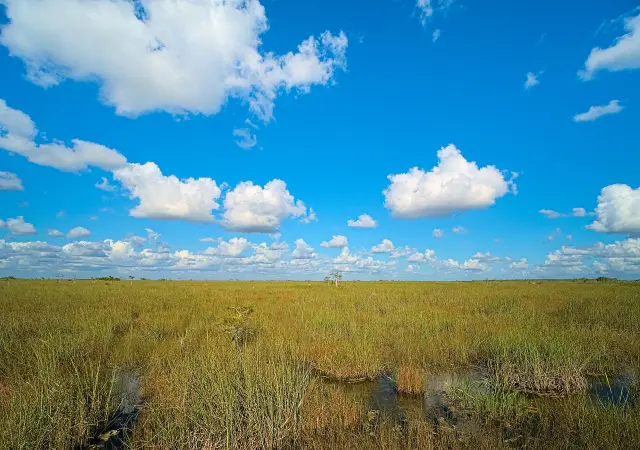
Brevard County describes pine flatwoods, cabbage palm hammocks, hardwood hammocks, mangrove forests and salt marshes there, kept as a refuge for the West Indian manatee, bottlenose dolphin, alligator, wood stork, osprey, gopher tortoise, bobcat and eastern indigo snake (Brevard County EEL Program FAQs). The county also says that with restoration of the historic Sams House, Pine Island will host the Central Region's management and education center.
The Pine Island listing on FWC's Great Florida Birding and Wildlife Trail gives the site as free to enter, open daily from dawn to dusk, and managed by Brevard County and the water management district, with viewing blinds on several interior ponds (Great Florida Birding and Wildlife Trail, Pine Island Conservation Area). The listing suggests picking up a map at the entrance kiosk and notes that canoes or kayaks can be launched in the ponds at the north and south ends, with a paddle route by Sam's Creek out to the Indian River Lagoon.
Two figures differ between the birding trail listing and the county pages. The trail listing gives the size as 946 acres and the entrance as 2121 Pine Island Rd., Merritt Island (Great Florida Birding and Wildlife Trail, Pine Island Conservation Area), while Brevard County gives 879 acres (Brevard County EEL Program FAQs) and lists the conservation area at 2100 Pine Island Road (Brevard County EEL Sanctuaries directory).
What is Buck Lake Conservation Area in North Brevard like?
Buck Lake, on Brevard County's North Region EEL list, is a water management district property with almost 30 miles of trails (St. Johns River Water Management District, Buck Lake Conservation Area).
It sits at the northern end of the Upper St. Johns River Basin Project, a joint project with the U.S. Army Corps of Engineers, and the district describes 15 distinct natural community types, from dry sandy scrub to wide floodplains, and calls Buck Lake the most ecologically diverse property in its south-central region (St. Johns River Water Management District, Buck Lake Conservation Area). A ridge on the east side holds scrubby flatwoods and oak hammock suited to Florida scrub-jays, a basin swamp covers the eastern third and feeds the headwaters of Six Mile Creek, and the creek runs south to Salt Lake, Loughman Lake and the St. Johns River. The district also points out rare inland salt flats along the St. Johns River floodplain, relics of a time when sea levels were much higher.
The district lists seasonal hunting, hiking, horseback riding, bicycling, fishing, wildlife viewing and primitive camping at designated sites (St. Johns River Water Management District, Buck Lake Conservation Area). The district links its hunting information from the same page. On the county side, Buck Lake falls under the North Region superintendent line, (321) 264-5185 (Brevard County EEL Land Management and Restoration page).
Which other EEL sanctuaries sit around Titusville, Mims and Scottsmoor?
Besides Enchanted Forest and Buck Lake, North Brevard's EEL list holds Dicerandra Scrub and Fox Lake in Titusville, Indian Mound Station and South Lake in Mims, and the two Scottsmoor Flatwoods sanctuaries (Brevard County EEL Sanctuaries directory).
Enchanted Forest, at 393 acres on State Road 405 just west of U.S. Highway 1 in Titusville, is the program's flagship and the North Region's management and education center (Brevard County EEL Program FAQs); the Titusville Enchanted Forest Sanctuary guide covers it in detail. The other North Brevard sites appear in the county directory with an address and phone only: Indian Mound Station Sanctuary at 4001 Parrish Road, the South Lake Conservation Area at 4500 Lancaster Lane, and Scottsmoor Flatwoods Sanctuary West at 5000 Rose Marie Pl. in Mims, with Scottsmoor Flatwoods Sanctuary East at 6000 Magoon Avenue in Scottsmoor (Brevard County EEL Sanctuaries directory).
After its main Brevard Coastal Scrub Ecosystem focus, the EEL Program names the North Indian River Lagoon Blueways project, which targets lands in North Brevard County to protect the headwaters of the Indian River Lagoon, as its second acquisition area (Brevard County EEL Land Management and Restoration page). Only land recommended by the EEL Selection and Management Committee, whose members the Board of County Commissioners selects, can be bought with EEL funds. The two county pages describe the committee differently: the land management page gives eight members, seven scientists and one representing ecotourism interests (Brevard County EEL Land Management and Restoration page), while the FAQ page gives seven members, each a scientist (Brevard County EEL Program FAQs).
Where are the Central Region EEL sites in Rockledge, Cocoa Beach and Merritt Island?
Beyond Pine Island, the Central Region covers the Helen and Allan Cruickshank Sanctuary in Rockledge, Thousand Islands Conservation Area in Cocoa Beach and Ulumay Wildlife Sanctuary on Merritt Island (Brevard County EEL Sanctuaries directory).
The county directory places the Cruickshank sanctuary at 360 Barnes Boulevard in Rockledge, Thousand Islands Conservation Area at 599 Ramp Road in Cocoa Beach and Ulumay Wildlife Sanctuary at 805 Sykes Creek Parkway on Merritt Island, and it tags Ulumay with a non-motorized boat ramp (Brevard County EEL Sanctuaries directory). All three list the EEL office number, (321) 255-4466, while the Pine Island and Sams House entries list the Central Region line.
The Central Region superintendent line listed with the region's sites is (321) 449-4720 (Brevard County EEL Land Management and Restoration page). Paddling near Ramp Road is covered in the Cocoa Beach kayaking and paddling guide on this site.
Why are fires set and plants removed on North and Central Brevard sanctuaries?
Brevard County says its EEL land managers must recreate the fire, water flow and weather cycles that roads and development have broken, and its examples of that work include prescribed fire, invasive plant removal and hydrologic restoration (Brevard County EEL Land Management and Restoration page).
The county's list of management work on EEL lands in Brevard County covers securing property boundaries, setting prescribed fires, removing invasive plants, restoring hydrological cycles and building public access trails, with goals set out in the EEL Sanctuary Management Manual (Brevard County EEL Land Management and Restoration page). The program says buying land for conservation brings a pledge to manage it for the long term.
The FAQ page says one EEL land manager is assigned to each of the program's four management areas, North, Central, South and South Beaches, and that the managers write a management plan for each sanctuary in their region setting its land management goals and its passive recreation and education activities (Brevard County EEL Program FAQs). The county's own examples of passive recreation on EEL sanctuaries include hiking, guided nature tours, canoeing and kayaking, bicycling, bird watching, horseback riding and catch-and-release fishing, and it adds that not every activity occurs on every sanctuary.
Last verified: October 21, 2026, against the Brevard County EEL land management, FAQ and sanctuaries directory pages, the water management district's Buck Lake page and the birding trail's Pine Island page.
Frequently asked questions
What EEL sanctuaries are in Titusville?
Brevard County's directory lists Dicerandra Scrub Sanctuary, Enchanted Forest Sanctuary and Fox Lake Sanctuary with Titusville addresses, all under the North Region line, (321) 264-5185.
Is Pine Island Conservation Area free?
Yes. The Great Florida Birding and Wildlife Trail lists Pine Island as free to enter and open daily from dawn to dusk.
Is camping or horseback riding allowed at Buck Lake Conservation Area?
The St. Johns River Water Management District lists horseback riding, bicycling and primitive camping at designated sites at Buck Lake, along with seasonal hunting, hiking and fishing.
What phone line covers EEL sanctuaries on Merritt Island?
Brevard County lists the Central Region superintendent line, (321) 449-4720, for Pine Island and Sams House, and the EEL office, (321) 255-4466, for other Central Region sites such as Ulumay.
Which EEL site in Central Brevard has a boat ramp?
The county directory tags Ulumay Wildlife Sanctuary, 805 Sykes Creek Parkway on Merritt Island, with a non-motorized boat ramp.
Sources
- Land Management and Restoration, Brevard County EEL Program https://www.brevardfl.gov/EELProgram/LandManagementAndRestoration Used for: North and Central region lists and phones, management activities, selection committee, acquisition projects, admin office
- EEL Program FAQs, Brevard County https://www.brevardfl.gov/EELProgram/EELProgramFAQs Used for: program origin, acreage, categories, Enchanted Forest and Pine Island descriptions
- EEL Sanctuaries directory, Brevard County https://www.brevardfl.gov/EELProgram/Sanctuaries Used for: sanctuary addresses, phones, education centers
- Buck Lake Conservation Area, St. Johns River Water Management District https://www.sjrwmd.com/lands/recreation/buck-lake/ Used for: Buck Lake habitats, basin project, trails and activities
- Pine Island Conservation Area, Great Florida Birding and Wildlife Trail https://floridabirdingtrail.com/site/pine-island-conservation-area/ Used for: Pine Island hours, size, entrance, blinds, paddling
Published by Rytas Dirse, Solo Founder & AI Architect
Built with AI, held to quality gates. US sources, US brands, facts only.
How this page was made
Digital Towns uses AI assistance to research and write its guides, and every page is only as good as the sources it cites. Our goal is the most accurate, useful local information possible.
If you see an error, or anything you can show is false, tell us right away and we will take a third look.
Report an error
Thank you. We'll take a third look and correct the page if it's wrong.